Civil Design and Geomatics
Our civil design and geomatics team is tightly integrated with our geotechnical and environmental team to provide informed results
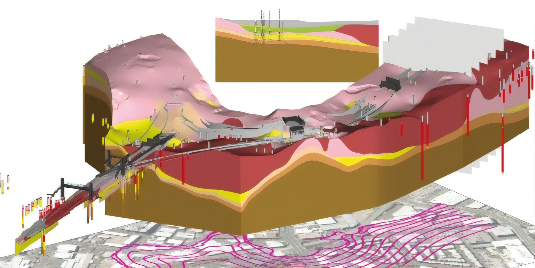
Geomatics
We can use soil, groundwater and other information to produce detailed 2D and 3D visualisations to realise the potential of your data.
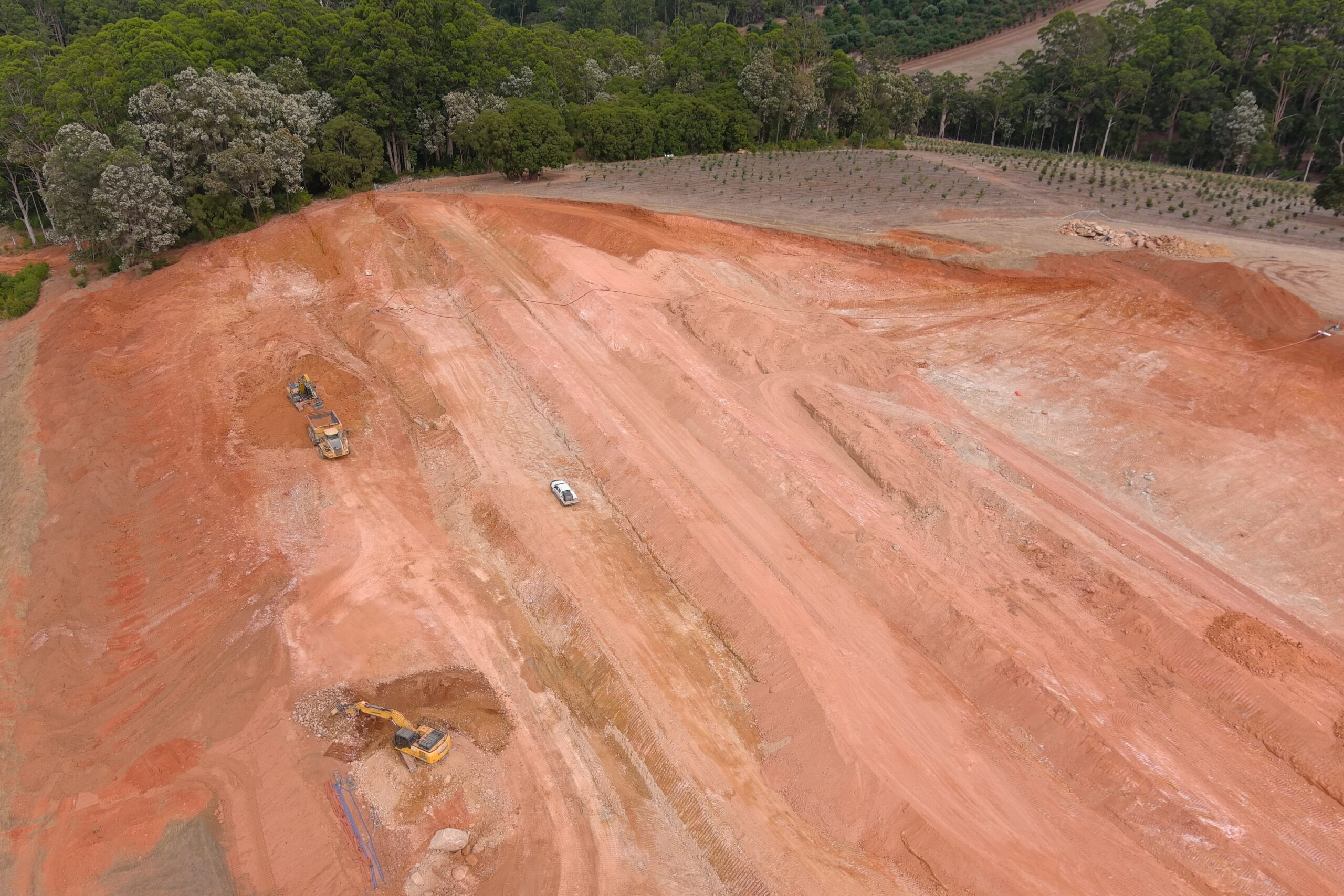
Civil Design
Galt can provide design of earthworks, drainage and dams including for construction drawings, specifications and quantities
Data Collation
We can take our investigation data and any existing data including survey and aerial photography, and integrate in your project.